Ron Watson Park
Ravine / Naturalized Park, middle of the pack overall (score 36, rank ~59th percentile). Strongest: amenity diversity; weakest: edge activation.
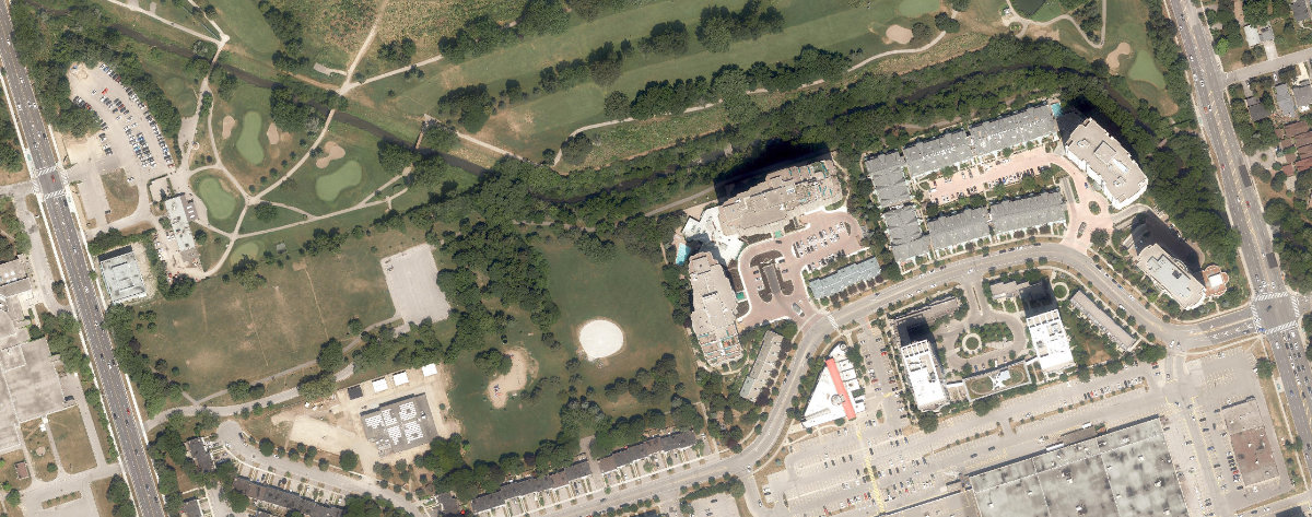
Aerial, City of Toronto orthophoto, ~8 cm/px source · cached 5/9/2026
Ron Watson Park scores 36.1 / 100. Strongest dimensions: enclosure / eyes on park and connectivity. Weakest: edge activation (0). Border-vacuum risk is elevated (48). This score is a transparent reading of Jane Jacobs-style vitality factors, not a definitive judgment.
Area · 7.42 ha
Weighted across six dimensions · confidence 72%
Scores are not bell-curved. Percentiles and expected scores provide context without changing the underlying model.
Loading map…
The parks map is loading.Explain this score
Where did the 36 come from? Each weighted contribution against a neutral 50 baseline. Green = pushed up; red = pulled down.
Sum of contributions = the headline score. A negative bar means that dimension dragged the park below the city-wide neutral baseline.
Why this park works
Ron Watson Park works because its amenity diversity score (21) is in the top tier and its natural comfort (59) is also above-average.
What limits this park
Ron Watson Park is held back by edge activation (0, bottom quartile): the surrounding streets carry too few active uses to spill into the park; border-vacuum risk is also elevated (48).
Most distinctive characteristic
Most distinctive feature: exceptionally high amenity diversity (21, top quartile).
Jacobs reading
Ron Watson Park sits between an urban social park and an ecological retreat: moderately useful for both, exceptionally suited to neither.
Tradeoffs
- The park is enclosed by buildings (61) but the surrounding streets are quiet (edge activation 0): frame without animation.
Typology classification
Classified as Ravine / Naturalized Park: 40% ravine overlap, 11% canopy. Secondary read: Corridor / Linear Park (shape elongation 2.3× a circle of equal area).
Edge Activation
Within 100 m of the park edge: 3 active uses (transit_stop) and 10 dead/hostile uses (parking_lot). Active edges keep "eyes on the park" through the day; parking lots, blank institutional walls, rail and highway frontages drain street life.
Source: OSM POIs (amenity/shop) + Toronto Building Footprints + land use
Connectivity
Connectivity blends paths, intersections, transit, entrances, and edge density. This park has 3 mapped paths/walkways and 24 sidewalk segments within 50 m; 8 street intersections within 100 m; 16 transit stops within a 400 m walk; 6 estimated access points across ~2,199 m of perimeter. low edge density, significant superblock penalty applied. Source coverage: centreline, pedestrian_network, transit_osm.
Source: Toronto Centreline V2 + Pedestrian Network + OSM transit stops
Amenity Diversity
2 distinct amenity types in the park (playground, sports_field). Diversity, not raw count, drives the score so a park with many distinct activity types can outrank a larger park that repeats the same use.
Source: Toronto Parks & Recreation Facilities + OSM amenity tags
Natural Comfort
Natural-comfort components for this park: 10.5% estimated tree canopy; 40.4% inside the ravine system; 4.4% water surface; 38 city-mapped trees inside the polygon (5.1/ha). Reading: ravine-cooled. Source coverage: treed_area, ravine, waterbodies, street_trees. Impervious surface is approximated (Toronto's authoritative layer ships only as a raster GeoTIFF).
Source: Toronto Treed Area + Ravine + Waterbodies + Street Tree Inventory
Enclosure / Eyes on Park
51 buildings within 25 m of the park edge (10 mid-rise, 30 low-rise, 11 tower); avg edge height 19.0 m (~6 floors); 2.3 buildings per 100 m of 2,199 m perimeter (moderate frontage density); edges are at a Jacobs-scale walkable mid-rise (3 to 7 floors); 11 towers ≥ 40 m within 25 m of the edge. "Eyes on the park" come strongest from the 10 mid-rise edge buildings.
Source: Toronto 3D Massing (building footprints + heights)
Border Vacuum Risk
Border-vacuum factors within 50 m of the park: parking_lot, parking_lot, parking_lot, parking_lot. Jacobs warned that highways, rail, parking lots and blank institutional edges act as "vacuums" that suppress foot traffic and isolate the park from its neighbourhood.
Source: Toronto Street Centreline (highways) + rail layer + OSM landuse + building footprints
Equity Context
Equity Context requires inputs not yet loaded for this park (Toronto Neighbourhood Profiles). Score is held at a neutral 50 with low confidence. Read with caution.
Source: Toronto Neighbourhood Profiles
Amenities (2 types · 2 records)
- playground
- sports field
Nearby active-edge features (73)
- parking lot0 m
- transit stop: Marilyn Avenue8 m
- parking lot12 m
- parking lot36 m
- parking lot44 m
- transit stop: 2450 Birchmount Road (Stephen Leacock Collegiate)55 m
- parking lot57 m
- parking lot58 m
- transit stop: Marilyn Avenue59 m
- parking lot67 m
- parking lot68 m
- parking lot87 m
- parking lot94 m
- parking lot101 m
- parking lot102 m
- parking lot114 m
- parking lot115 m
- transit stop: Reidmount Avenue120 m
- parking lot120 m
- transit stop: Bonis Avenue123 m
- transit stop: Cardwell Avenue125 m
- parking lot125 m
- retail: KY Hair Salon127 m
- retail: World Sew127 m
- retail: Agincourt Shoe Repair128 m
- retail: A.K. Comics & Cards129 m
- transit stop: Birchmount Road at Bay Mills Boulevard129 m
- retail: Freedom Mobile130 m
- parking lot131 m
- retail: Angelique Flowers131 m
- retail: Fido132 m
- restaurant: Asian Fusion134 m
- retail: Alma Tours135 m
- retail136 m
- retail: Health & Life138 m
- retail: Agincourt Fruit Market139 m
- retail: CellRox141 m
- retail: Agincourt Optical143 m
- retail: Chatr144 m
- retail: Cellular Point145 m
- cafe: Tim Hortons149 m
- transit stop: 2481 Birchmount Road149 m
- retail: Kin-Kin151 m
- retail: Cellular Spa152 m
- parking lot155 m
- retail: Today's Bed & Bath155 m
- retail: Ducatti Shoes158 m
- parking lot159 m
- retail: Yat Lee Jewellery161 m
- retail: The Beer Store163 m
- retail: World Fashion165 m
- retail: Shiny Spa & Salon166 m
- transit stop: Kennedy Rd at Reidmount Ave166 m
- retail: Kool Look169 m
- retail: Harshi Furniture169 m
- retail: Home Decor Shoppe171 m
- retail: Daisy Mart171 m
- retail: OnSale Mart172 m
- transit stop: Birchmount Road at Bonis Avenue173 m
- retail: Ariana Rugs173 m
- retail: Bulk Food Centre174 m
- parking lot174 m
- restaurant: Subway181 m
- retail: International News182 m
- restaurant: McDonald's182 m
- restaurant: Burger King183 m
- parking lot184 m
- parking lot185 m
- retail: Multi Accessories190 m
- restaurant: Pizza Pizza190 m
- parking lot191 m
- retail: M&M Food Market196 m
- retail: LCBO197 m
Park profile
Five-axis radar across the structural dimensions.
Citywide percentile ranks
Across all Toronto parks in the dataset.
- Overall vitality59th
- Edge activation20th
- Connectivity71th
- Amenity diversity86th
- Natural comfort73th
- Enclosure42th
Most similar parks
Closest in metric space across the five structural dimensions.
- Ancona ParkNeighbourhood Park40
- Serena Gundy ParkRavine / Naturalized Park32
- Lynngate ParkNeighbourhood Park41
- Rustic ParkParkette39
- Diana ParkRavine / Naturalized Park41
Most opposite parks
Furthest in metric space. Useful for recognising what kind of park this isn’t.
- ALEX WILSON COMMUNITY GARDEN - Open Green SpaceUrban Plaza59
- Market Lane ParkUrban Plaza63
- Leslie Grove ParkParkette68
- Bernard Avenue Road AllowanceUrban Plaza54
- Ryerson Community ParkUrban Plaza60
Human activity signals: not available
No activity signals have landed for this park yet. The model has scored its physical form but it can’t yet say how often it’s programmed, photographed, or walked through. See /data-ethics for what we will and will not collect.
Does this score feel accurate?
Your read of Ron Watson Parkmatters. We’re testing whether the model lines up with how people actually use the park. Submissions are stored locally; no account needed.
Tell us how this park feels
We measure structure (canopy, edges, connectivity). You measure feeling. Both matter, and disagreement is itself useful civic data.
What would improve this park?
Generated from the weakest measured dimensions: a starting point, not a prescription.
- Activate the edges: encourage cafés, retail or community uses on the streets that face the park; replace blank or parking-lot edges where possible.
- Diversify what people can do in the park (playground, washroom, water, shade, performance, sport, garden): even small additions raise this score.
- Mitigate border vacuums (highways, rail, parking) with active programming on the still-permeable edges and treat the hostile edge as a design challenge.
Data sources
- City of Toronto Open Data: Parks (Green Space)Polygon boundaries, official names, types.
- Parks & Recreation FacilitiesInventory of in-park amenities (washrooms, fields, rinks…).
- Toronto Pedestrian NetworkSidewalk segments around and through parks; estimated park entrances.
- Toronto Centreline V2Street segments + intersection nodes near park edges; trails and walkways.
- Toronto 3D MassingBuilding footprints + heights for edge-building counts, frontage density, and tower-in-the-park risk.
- Toronto Treed AreaTree canopy share inside park polygons via stratified-grid sampling.
- Toronto Waterbodies & RiversWater surface inside parks + nearest-water distance for cooling.
- Ravine & Natural Feature ProtectionRavine overlap as a cooling / natural-comfort signal.
- Toronto Street Tree InventoryTree count + density inside park polygons.
- Neighbourhood Profiles(Pending) Equity context proxy.
- OpenStreetMap (Overpass API)Cafés, restaurants, retail, transit stops, parking, highways, rail.