Beaty Boulevard Parkette
Corridor / Linear Park, middle of the pack overall (score 38, rank ~69th percentile). Strongest: connectivity; weakest: edge activation.
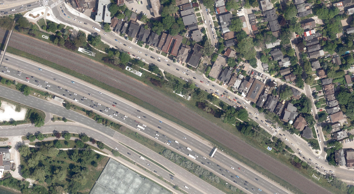
Aerial, City of Toronto orthophoto, ~8 cm/px source · cached 5/9/2026
Beaty Boulevard Parkette scores 38.4 / 100. Strongest dimensions: enclosure / eyes on park and connectivity. Weakest: amenity diversity (0). Border-vacuum risk is low. This score is a transparent reading of Jane Jacobs-style vitality factors, not a definitive judgment.
Area · 0.54 ha
Weighted across six dimensions · confidence 59%
Scores are not bell-curved. Percentiles and expected scores provide context without changing the underlying model.
Loading map…
The parks map is loading.Explain this score
Where did the 38 come from? Each weighted contribution against a neutral 50 baseline. Green = pushed up; red = pulled down.
Sum of contributions = the headline score. A negative bar means that dimension dragged the park below the city-wide neutral baseline.
Why this park works
Beaty Boulevard Parkette works because its connectivity score (74) is in the top tier and its enclosure (78) is also top quartile (22 transit stops sit within a 400 m walk; 10 intersections fall within 100 m of the edge).
What limits this park
Beaty Boulevard Parkette is held back by edge activation (0, below-average): the surrounding streets carry too few active uses to spill into the park.
Most distinctive characteristic
Most distinctive feature: exceptionally high connectivity (74, top decile).
Jacobs reading
Beaty Boulevard Parkette sits between an urban social park and an ecological retreat: moderately useful for both, exceptionally suited to neither.
Tradeoffs
- Connectivity (74) significantly outpaces natural comfort (46): well placed in the city but offers little shade or ecological respite.
- The park is enclosed by buildings (78) but the surrounding streets are quiet (edge activation 0): frame without animation.
Performance in context
- A modest overperformer for its corridor / linear park typology (+6 vs the median in small Corridor / Linear Park).
Typology classification
Classified as Corridor / Linear Park: shape elongation 3.6× a circle of equal area. Secondary read: Urban Plaza (5397 m², paved (0% canopy), 7.1 buildings/100 m).
Edge Activation
Within 100 m of the park edge: 35 active uses (restaurant, transit_stop, retail, cafe) and 16 dead/hostile uses (highway, parking_lot, rail). Active edges keep "eyes on the park" through the day; parking lots, blank institutional walls, rail and highway frontages drain street life.
Source: OSM POIs (amenity/shop) + Toronto Building Footprints + land use
Connectivity
Connectivity blends paths, intersections, transit, entrances, and edge density. This park has 14 mapped paths/walkways and 28 sidewalk segments within 50 m; 10 street intersections within 100 m; 22 transit stops within a 400 m walk; 12 estimated access points across ~939 m of perimeter. moderate edge density, small superblock penalty applied. Source coverage: centreline, pedestrian_network, transit_osm.
Source: Toronto Centreline V2 + Pedestrian Network + OSM transit stops
Amenity Diversity
No amenities recorded. Score is 0 until inventory is loaded.
Source: Toronto Parks & Recreation Facilities + OSM amenity tags
Natural Comfort
Natural-comfort components for this park: ~10.5% effective canopy (0.0% from contiguous tree polygons + scattered tree density); nearest waterbody ~217 m; 15 city-mapped trees inside the polygon (15.0/ha). Reading: exposed. Source coverage: waterbodies, street_trees. Impervious surface is approximated (Toronto's authoritative layer ships only as a raster GeoTIFF).
Source: Toronto Treed Area + Ravine + Waterbodies + Street Tree Inventory
Enclosure / Eyes on Park
67 buildings within 25 m of the park edge (22 mid-rise, 45 low-rise, 0 tower); avg edge height 8.4 m (~3 floors); 7.1 buildings per 100 m of 939 m perimeter (strong frontage density); edges are low-rise (mostly 2 to 3 floors); no towers immediately adjacent. "Eyes on the park" come strongest from the 22 mid-rise edge buildings.
Source: Toronto 3D Massing (building footprints + heights)
Border Vacuum Risk
Border-vacuum factors within 50 m of the park: parking_lot. Jacobs warned that highways, rail, parking lots and blank institutional edges act as "vacuums" that suppress foot traffic and isolate the park from its neighbourhood.
Source: Toronto Street Centreline (highways) + rail layer + OSM landuse + building footprints
Equity Context
Equity Context requires inputs not yet loaded for this park (Toronto Neighbourhood Profiles). Score is held at a neutral 50 with low confidence. Read with caution.
Source: Toronto Neighbourhood Profiles
Amenities (0)
No amenities recorded for this park.
Nearby active-edge features (80)
- transit stop: Wilson Park Road7 m
- transit stop: Wilson Park Road9 m
- transit stop: Queen Street West16 m
- parking lot27 m
- restaurant: Roja’s Kitchen34 m
- restaurant: McDonald's44 m
- restaurant: Easy Restaurant44 m
- retail: The Picture Frame Factory48 m
- transit stop: Roncesvalles Avenue54 m
- restaurant: Burrito Boyz55 m
- parking lot56 m
- retail: Sam The Chandelier Man56 m
- parking lot57 m
- parking lot58 m
- transit stop: Roncesvalles Avenue58 m
- retail: Vape60 m
- retail: A Room in Paris62 m
- transit stop: Queen Street West62 m
- retail: Era Antiques63 m
- transit stop: Roncesvalles Avenue64 m
- retail: Stella Luna66 m
- transit stop: Roncesvalles Avenue66 m
- parking lot68 m
- parking lot68 m
- retail: J Dy's Antiques68 m
- retail: Quickcart Convenience71 m
- retail: Classic Vintage Audio & Props71 m
- restaurant: Mama Rosa73 m
- parking lot77 m
- retail78 m
- cafe: Raid Gallery Cafe79 m
- retail: RAID82 m
- restaurant: South Indian Dosa Mahal83 m
- restaurant: The Grand Trunk Spirits & Libations83 m
- retail: Campagna Bronze85 m
- retail: West End Comics85 m
- cafe: Osprey88 m
- highway: Lake Shore Boulevard West89 m
- retail: Wave Electric Scooters90 m
- retail: In Good Co.92 m
- parking lot92 m
- parking lot92 m
- parking lot93 m
- restaurant: Paddler Thai boat noodles93 m
- highway: Lake Shore Boulevard West95 m
- retail: PetAgree95 m
- parking lot96 m
- highway: Lake Shore Boulevard West96 m
- rail: Oakville Subdivision98 m
- restaurant: Dystopia100 m
- parking lot100 m
- rail: Oakville Subdivision101 m
- parking lot102 m
- rail: Oakville Subdivision104 m
- highway: Lake Shore Boulevard West107 m
- rail: Oakville Subdivision108 m
- retail: Spiritleaf108 m
- transit stop: Queen Street West111 m
- retail: Cult 1696112 m
- retail: Hair Roncy112 m
- parking lot114 m
- retail: Peach Berserk117 m
- retail118 m
- retail: Atlas Ink120 m
- parking lot: Palais Royale Guest Parking121 m
- parking lot121 m
- restaurant: Sake Sushi122 m
- parking lot124 m
- restaurant: Krave Indian125 m
- cafe: Atlantis Coffee130 m
- highway: Lake Shore Boulevard West131 m
- retail: Savage Nails Lounge132 m
- retail: Studio 1686134 m
- parking lot134 m
- restaurant: Tdot Jerk136 m
- highway: Lake Shore Boulevard West137 m
- parking lot137 m
- retail: Juju Grooms138 m
- retail: Aroma Cannabis Emporium140 m
- restaurant: Ice Queen Restaurant143 m
Park profile
Five-axis radar across the structural dimensions.
Citywide percentile ranks
Across all Toronto parks in the dataset.
- Overall vitality69th
- Edge activation35th
- Connectivity95th
- Amenity diversity41th
- Natural comfort52th
- Enclosure81th
Most similar parks
Closest in metric space across the five structural dimensions.
- St. John'S Norway CemeteryRavine / Naturalized Park30
- St. James CemeteryRavine / Naturalized Park39
- Chandos Park NorthUrban Plaza38
- Beaver - Lightbourn ParketteUrban Plaza37
- Scarborough Hydro Green SpaceRavine / Naturalized Park30
Most opposite parks
Furthest in metric space. Useful for recognising what kind of park this isn’t.
- Toronto Islands - Muggs Island ParkRavine / Naturalized Park25
- Trca Lands ( 26)Ravine / Naturalized Park27
- Simcoe ParkTower-Community Green Space51
- Rouge ParkWaterfront Park25
- Rouge ParkRavine / Naturalized Park28
Human activity signals: not available
No activity signals have landed for this park yet. The model has scored its physical form but it can’t yet say how often it’s programmed, photographed, or walked through. See /data-ethics for what we will and will not collect.
Does this score feel accurate?
Your read of Beaty Boulevard Parkettematters. We’re testing whether the model lines up with how people actually use the park. Submissions are stored locally; no account needed.
Tell us how this park feels
We measure structure (canopy, edges, connectivity). You measure feeling. Both matter, and disagreement is itself useful civic data.
What would improve this park?
Generated from the weakest measured dimensions: a starting point, not a prescription.
- Activate the edges: encourage cafés, retail or community uses on the streets that face the park; replace blank or parking-lot edges where possible.
- Diversify what people can do in the park (playground, washroom, water, shade, performance, sport, garden): even small additions raise this score.
- Increase canopy and reduce paved area. Shade and water features extend usable hours and seasons.
Data sources
- City of Toronto Open Data: Parks (Green Space)Polygon boundaries, official names, types.
- Parks & Recreation FacilitiesInventory of in-park amenities (washrooms, fields, rinks…).
- Toronto Pedestrian NetworkSidewalk segments around and through parks; estimated park entrances.
- Toronto Centreline V2Street segments + intersection nodes near park edges; trails and walkways.
- Toronto 3D MassingBuilding footprints + heights for edge-building counts, frontage density, and tower-in-the-park risk.
- Toronto Treed AreaTree canopy share inside park polygons via stratified-grid sampling.
- Toronto Waterbodies & RiversWater surface inside parks + nearest-water distance for cooling.
- Ravine & Natural Feature ProtectionRavine overlap as a cooling / natural-comfort signal.
- Toronto Street Tree InventoryTree count + density inside park polygons.
- Neighbourhood Profiles(Pending) Equity context proxy.
- OpenStreetMap (Overpass API)Cafés, restaurants, retail, transit stops, parking, highways, rail.